
It was the four of us—Peter, Edu, Ben, and me—setting off from Vigo Real Marina Náutico in Spain with our sights set on Port Hamble Marina near Southampton, UK. Peter had assembled the crew, pulling in Edu and Ben through some savvy social media networking, and now we were ready for the journey ahead.
But as we prepared to depart, the tension rose. A notification came in: a yacht had been attacked by orcas just 35 km north of our Ría. We’d already reviewed the heatmaps on orcas.pt, which showed most attacks happened in shallow waters (0–200 meters). Our strategy was clear: avoid shallow areas and head for deep waters as quickly as possible.

To ensure safety, we hugged the cargo shipping lanes running along the coast at depths between 500 and 3,000 meters. The rationale? Fewer food sources for orcas and the cacophony from cargo ships would likely mask our presence from any curious orca pods.

This meant motoring for 12 hours straight until we reached deep enough waters to catch favorable winds. While some in the sailing community questioned why we were heading north in August when preparing for a transatlantic crossing with Viking Explorers, our reasoning was sound:
- Test the boat: A proper passage would reveal its true capabilities.
- Prepare for longer journeys: The trip would highlight areas needing improvement.
- Logistical needs: We needed to pick up the skipper’s wife, who could get a UK visa without using up valuable Schengen days—critical for extended stays in the Canary Islands.
Navigating Challenges: Orcas, Shipping Lanes, and the Bay of Biscay
Avoiding orcas wasn’t our only concern. The Bay of Biscay is infamous for its unpredictable weather and swells, while the English Channel is a maze of shipping traffic and challenging tides. Add to that a boat that didn’t perform well in winds below 11 knots, especially upwind at a 40-degree angle, and the obstacles started piling up.
Against the wind, we managed decent speed—until the relentless swells slammed into the bow every third wave, stalling us. When we finally hit a stride, the boat felt overpowered, forcing us to reef the sails. Much of the time, we motor-sailed, but at least the engine proved its efficiency, consuming minimal fuel despite the grueling conditions. With 200 liters in the tank and 80 liters on deck, we had enough to see us through.

As we headed north, the temperature plummeted. Gone were the mild nights of Vigo, where it hovered around 18°C. Now, I was layering everything I had—thermals, a sweater, fleece, and Musto waterproof gear—yet still shivering. We ran four-hour shifts with two crew on deck at all times for safety. Sleep was a luxury; even off-shift, we were lucky to grab two hours between sail adjustments or call-backs to deck.
The Chaos of Biscay
In the Bay of Biscay, chaos reigned. Naval ships played hide-and-seek with Russian vessels. Fishing boats, many without AIS signals, zigzagged unpredictably. Even commercial ships engaged in “clandestine maneuvers,” turning off their AIS to evade detection. Navigating through this minefield required constant vigilance. The radar, which we barely knew how to adjust, was more confusing than helpful, so we relied heavily on AIS and sharp eyes on deck.

Spotting the lights near Brest was a relief. Finally, land! With Starlink reconnecting once within 12 nautical miles of shore, we updated the UK authorities on our ETA and prepared to cross the English Channel.
The Wrath of the Channel
The English Channel greeted us with gale-force winds, towering swells, and erratic waves. The shallower waters combined with Atlantic swells made for brutal conditions, reducing our speed to a crawl—sometimes just 2 knots, even with the engine running. The heavy traffic of cargo ships and cruise liners added to the challenge. But after crossing the TSS (Traffic Separation Scheme), the winds mercifully died.

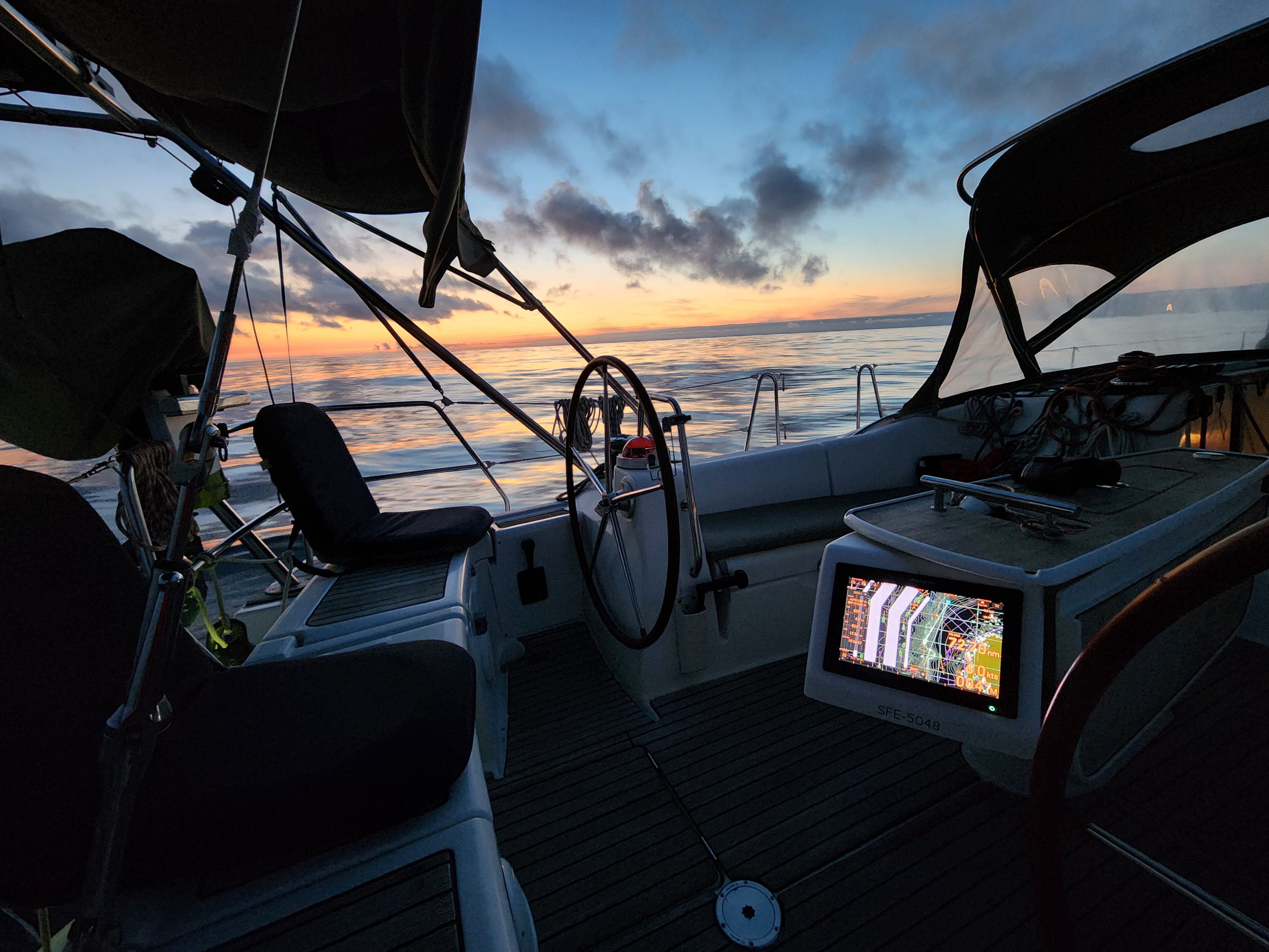
What followed was the calmest, most beautiful sunrise of the trip. We motored on, enjoying the reprieve after days of relentless battering.


Night Navigation Through the Needles
By the time we approached the Needles, it was midnight. Ideally, we’d have preferred daylight for this tricky passage, but we were eager to finish. Using every resource—chart plotters, navigation lights, and Peter’s trusty mobile navigation app—we inched our way through.
Fatigue tested us to the limit. At one point, a green navigation light appeared just 3 meters off the bow, unnoticed until the last second. A quick helm adjustment narrowly avoided grounding. It was a stark reminder of how exhaustion impacts even basic tasks.
Arrival at Port Hamble
Finally, we entered the Hamble River at high tide, exhausted but relieved. But as we called the marina on VHF, confusion struck: “We have no booking for you.” A quick clarification revealed we’d contacted the wrong marina—Port Hamble, not Point Hamble. The error resolved, we secured our berth at 4 a.m.
The UK immigration officer, understanding our state, advised us to rest and check in later. We didn’t argue. Over a celebratory beer and wine, we reflected on the 862-nautical-mile journey that had tested us in every way imaginable.
This wasn’t an easy passage by any standard. But it proved the boat’s seaworthiness and highlighted areas for improvement. As skipper on my first major voyage, I learned invaluable lessons. Huge thanks to the crew for their resilience and teamwork.

Our first proper English breakfast never tasted so good.
